| Permalink: | https://map.sekibutsu.info/archive/36235 ( マップ) |
| データ作成者: | Takashi KOIKE |
| データ作成日: | 2025年 7月 6日 |
©Takashi KOIKE (Licensed under CC BY 4.0)
| 写真撮影日: | 2025-07-06 |
| 緯度経度: | 35.560363, 139.413136 |
| 所在地: | 神奈川県相模原市中央区東淵野辺3丁目3(14152) |
| 場所: | 河本ファーム |
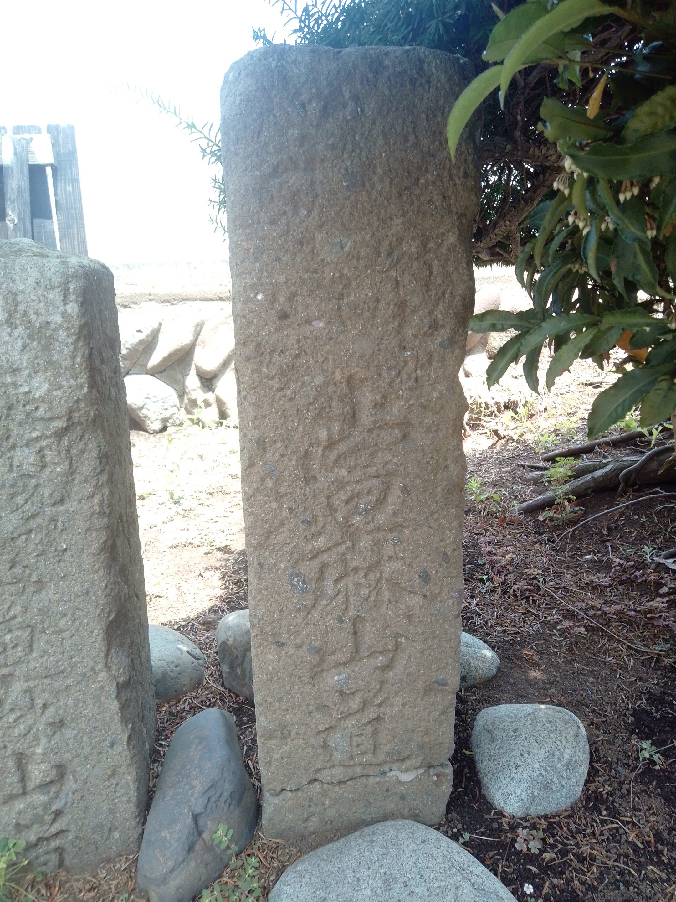
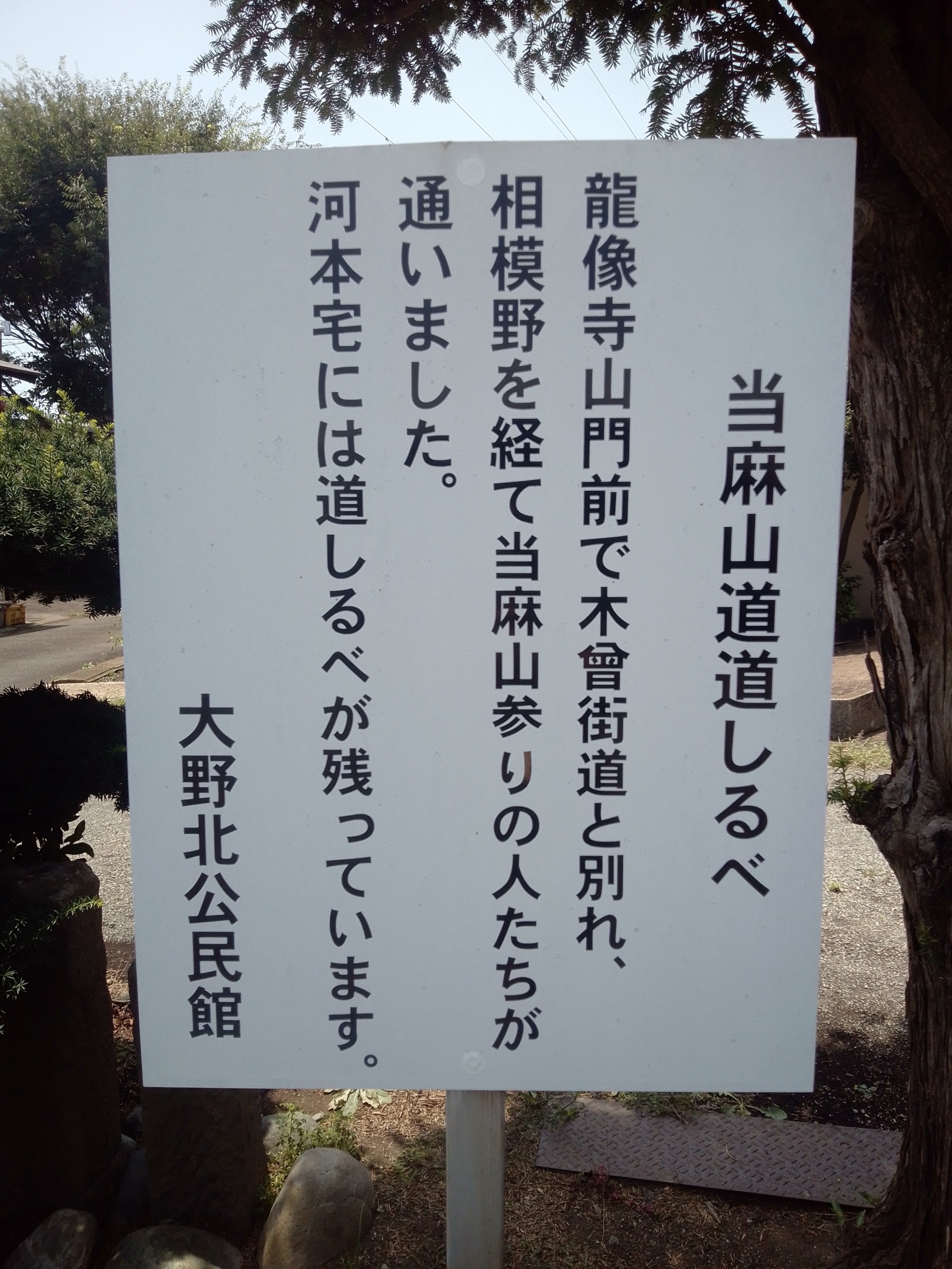
| 種類: | 道標 |
| 備考: | 「當麻山道」 |